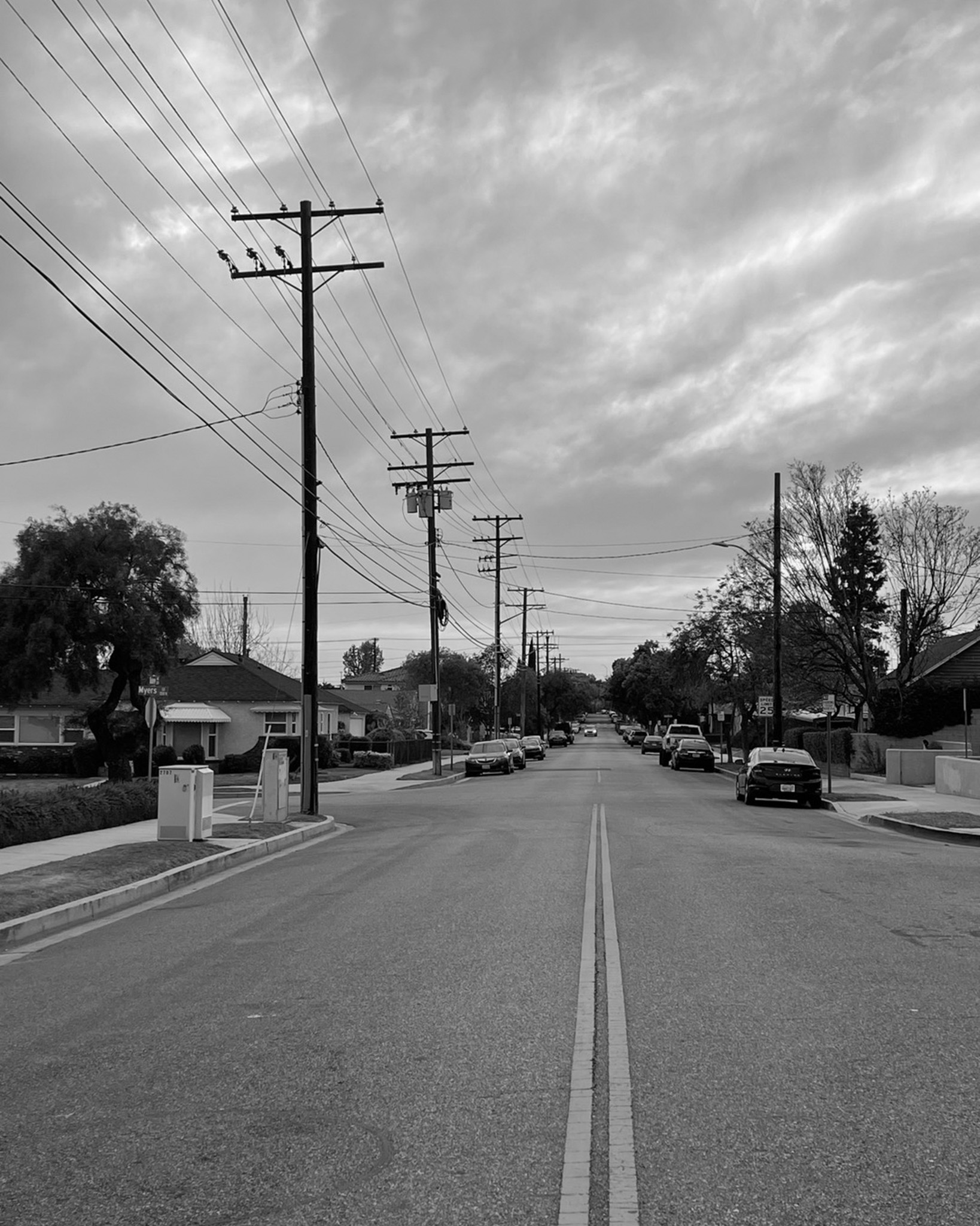
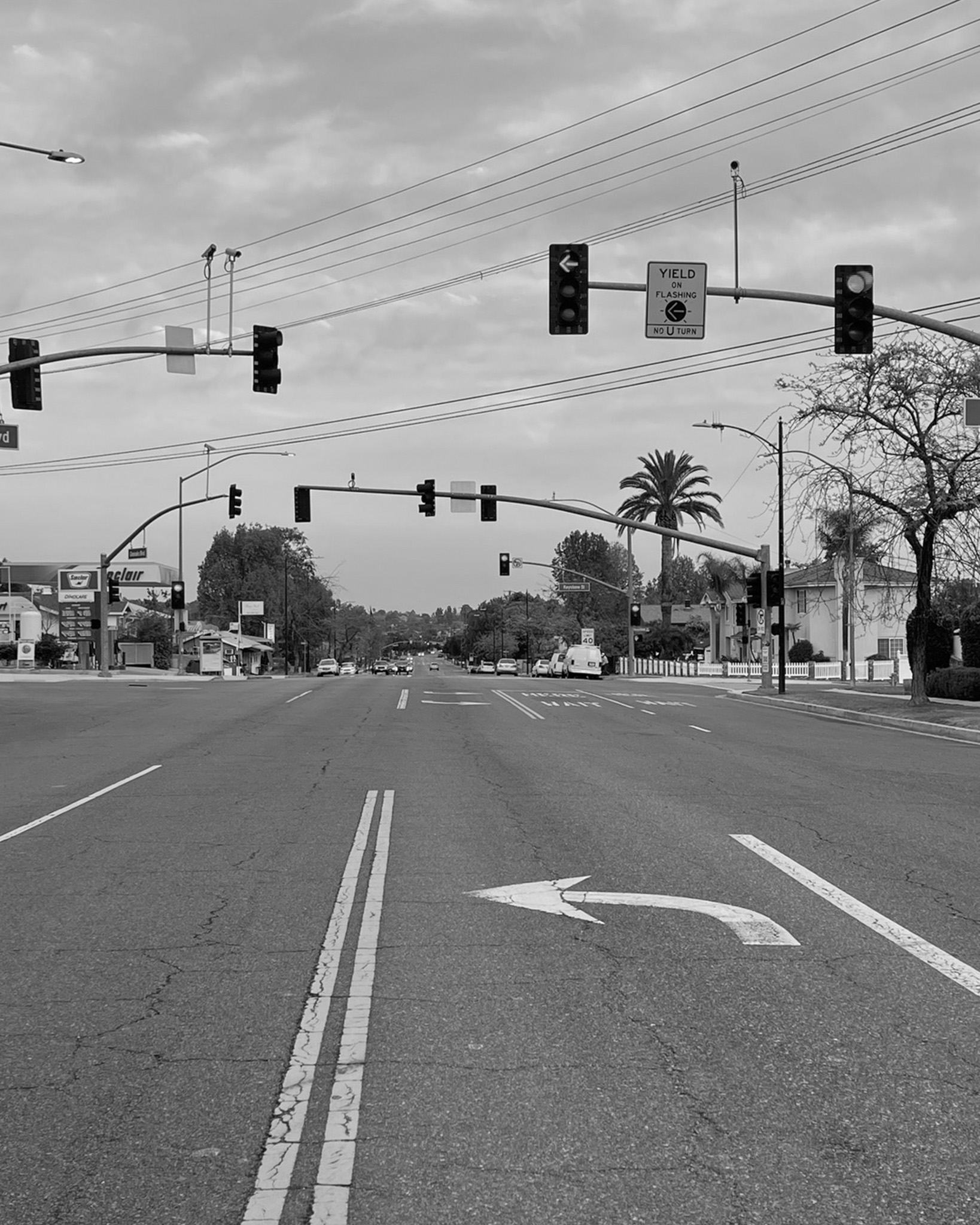
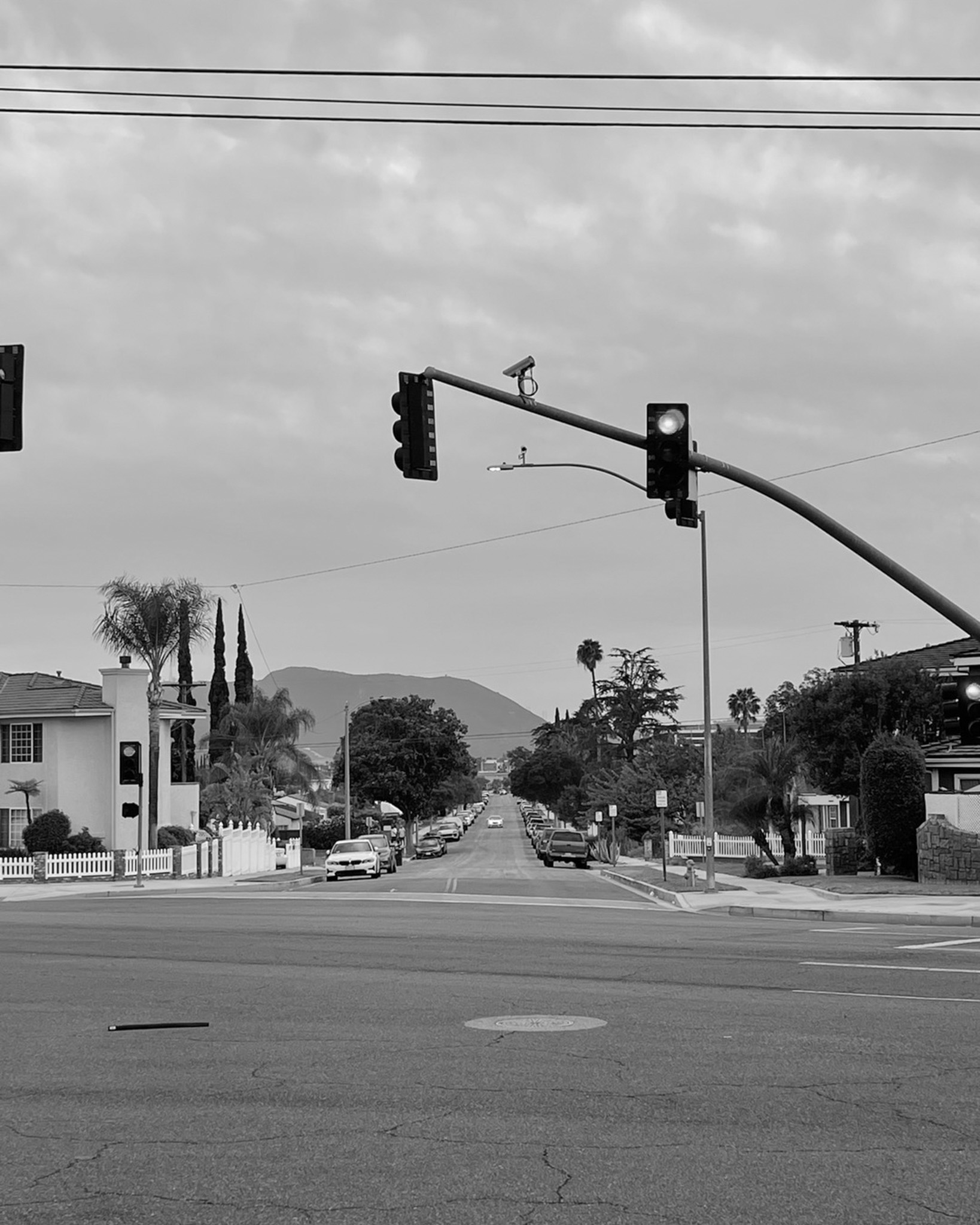
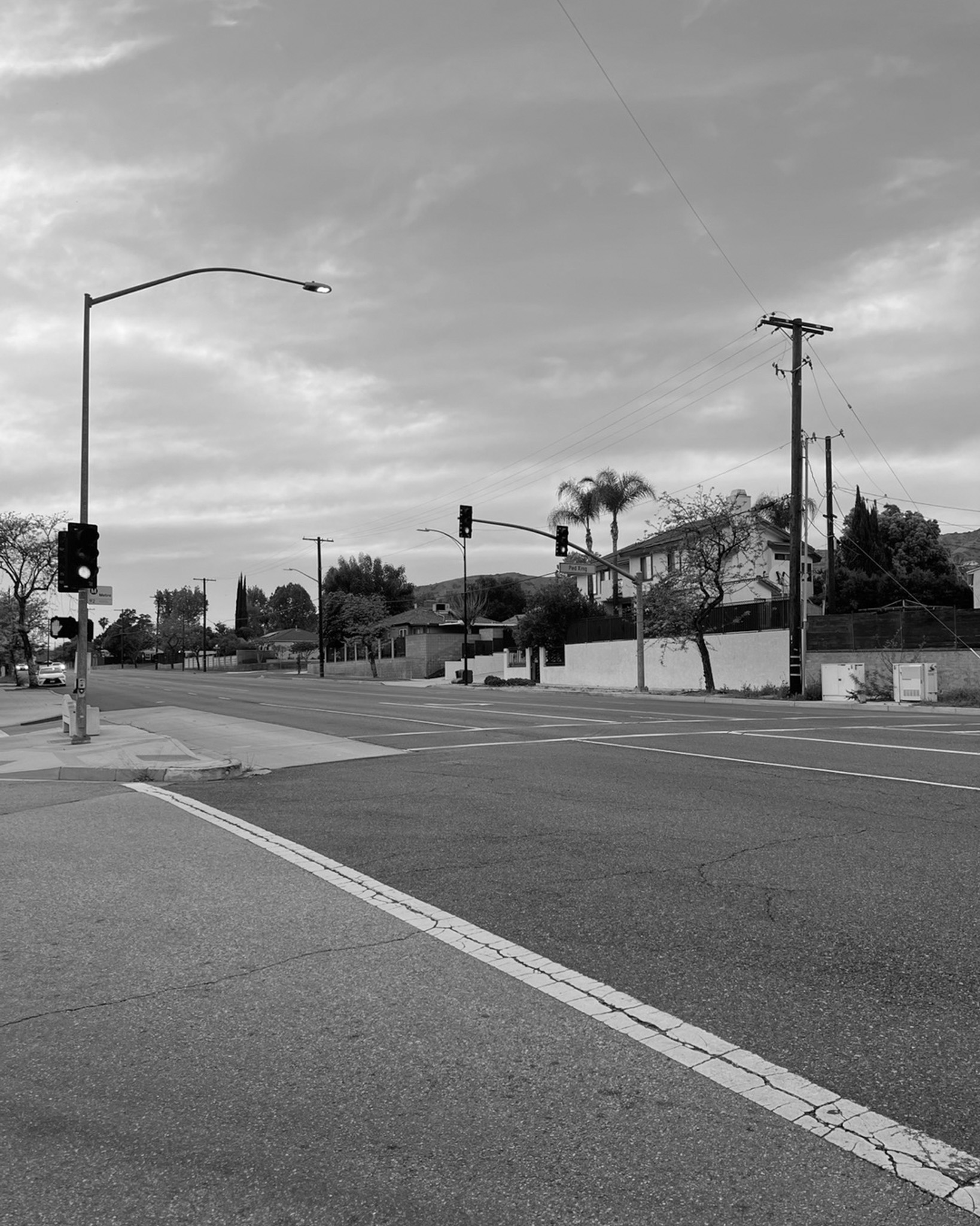
Roads & Sidewalks
“For every cubic meter of concrete used, we generate 100 to 300 kg of embodied CO2. (p. 51)” (1)
“Stories and ideas matter for the Earth. Stories are a means for understanding the world, for nurturing new habits of seeing, and ultimately, for projecting alternative forms of organizing life. (p.13)” (2)
1781
The establishment of the original settlement laid the groundwork for the street grid and urban development of Los Angeles. The initial layout, centered around the Plaza, dictated the orientation of some of the earliest streets.
1849
Following the U.S. acquisition of California, Ord’s survey provided a formal plan for the city’s streets, extending and confirming existing routes. This was crucial for the city’s first real estate boom.
1886
The extension of Los Angeles Street eliminated the alley and today the site adjoins the Hollywood Freeway.
1891
The very first concrete street in Los Angeles history was paved in 1891. The first paved streets are Main, Spring, and Fort (now Broadway).
1922
The increasing popularity of automobiles necessitated better road infrastructure. This era saw the initial paving and improvement of key streets to accommodate motorized vehicles.
1930
Development of Iconic Boulevards like Wilshire and Sunset: These grand boulevards became central arteries of the city, shaping commercial and residential development and embodying the image of Los Angeles.
1950
The extensive development of the freeway system dramatically altered the landscape and usage of surface streets, for better and worse, impacting traffic patterns and neighborhood connectivity.
1970
In the early 1970s, however, 5,000 local activists successfully prevented the cement paving of most of that stretch. The paved road begins again east of Topanga Canyon Boulevard at Santa Maria Road. Shortly thereafter, the thoroughfare splits into Mulholland Drive and Mulholland Highway. Mulholland Drive terminates at U.S. Highway 101 (the Ventura Freeway), where it becomes Valley Circle Boulevard.
1984
The city’s hosting of the Olympics led to significant infrastructure improvements, including enhancements to streets and transportation networks to accommodate the influx of visitors and events. Tenth Street was notably renamed Olympic Boulevard in honor of the games.
2000
In recent decades, there has been an increasing focus on pedestrian and cyclist safety, street beautification projects, and adapting streets for new modes of transportation, reflecting a changing urban planning philosophy. (3)
“The rapid growth of urban centers leaves little room, and time, to adequately receive the population influx. Buildings are demolished and rebuilt, while informal communities burgeon with new dwellers. The construction debris generated in the wake of redevelopment projects is exponentially increasing, in some cases annually resulting in millions of tons. This rate of dangerous development begs to be relinquished. Our building and construction system have failed us. (p.39)” (1)
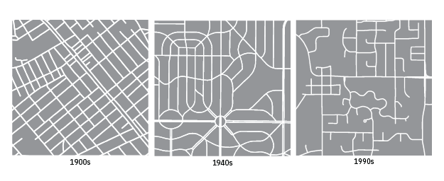
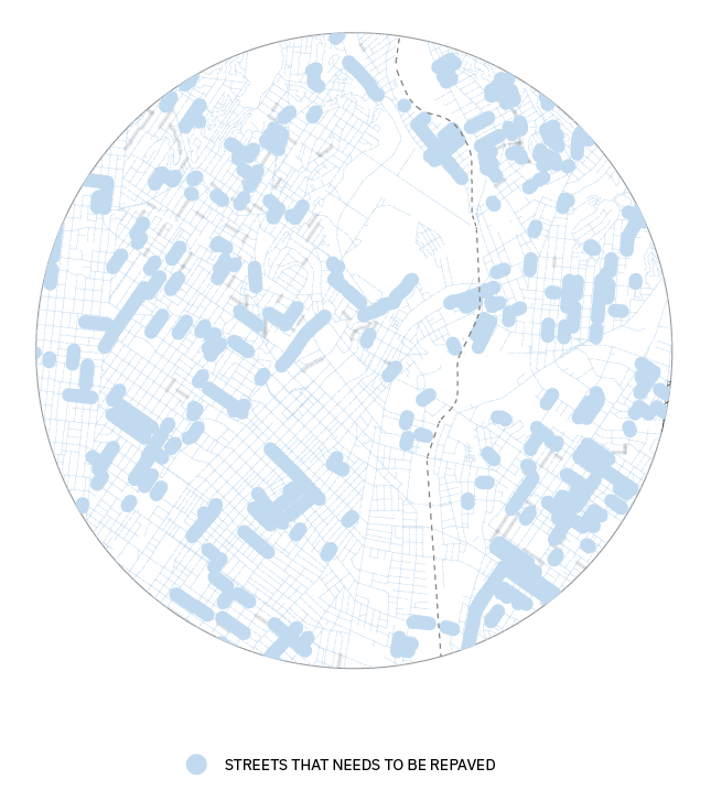
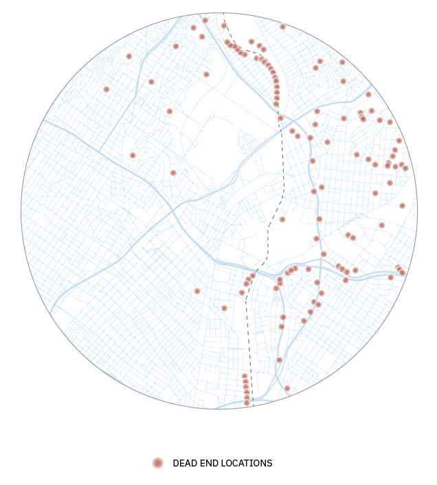
Early 20th-century urban planning favored dense, interconnected, walkable grids. However, post-World War II, there was a shift towards car-centric suburban development with more circuitous layouts. This trend culminated in the 1990s with the dominance of disconnected, dendritic, car-dependent sprawl. Indicators of street network design (griddedness, connectedness, density, and straightness) consistently declined from their pre-war peak through the 1990s, regardless of the estimation method used. Notably, these negative trends have reversed in the past two decades.
Pre-1940 urban areas exhibit significantly higher griddedness (84% more) and lower proportions of dead-ends (163% less) compared to 1990s urban areas. Street networks in the earlier period were also finer-grained, with double the intersection density and 20% shorter street segments. However, since 2000, griddedness and similar indicators have rebounded to levels comparable to the mid-20th century. (2)
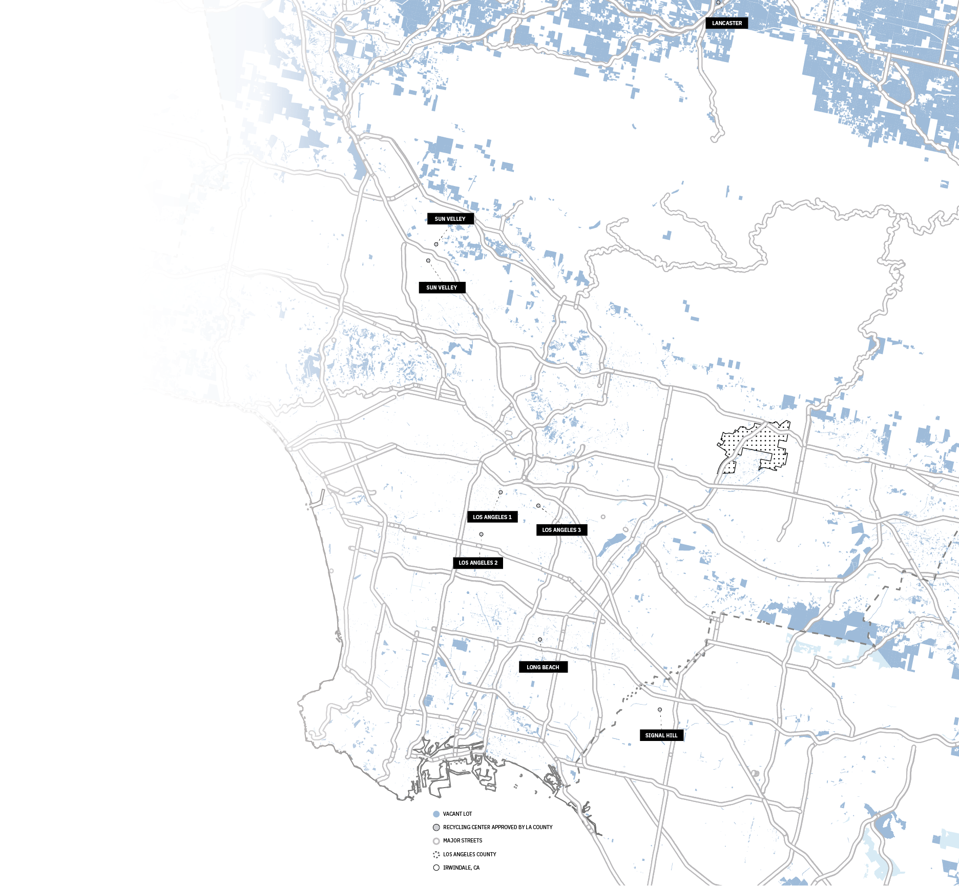
3 locations near project site:
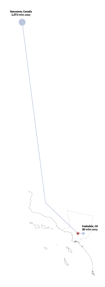
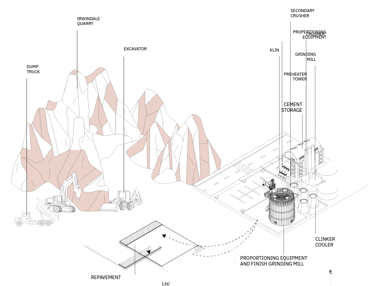
The city of Los Angeles gives a list of construction and demolition debris approved recycling facilities. It goes to the recycling facilities. There are three locations near the project site.
3720 Noakes St., Los Angeles, CA 9002 (3 miles away from the project site)
2221 E Washington Blvd., Los Angeles, CA 90021 (3 miles away from the project site)
6510 Stanford Ave., Los Angeles, CA 90001 (7 miles away from the project site)
The concrete chunks will be put through the crushing machine then filtered again for enhanced purity. The recycled concrete is used in numerous applications including:
Gravel for new construction projects
Dry aggregate for making new concrete
Riprap revetments for controlling streambank erosion
As an attractive substitute for landscaping mulch or stone
As crushed concrete to create retaining walls and privacy screening walls (4)
STREET &
WEIGHT
BOULEVARD
FOR STREET:
5280 ft. x 100 ft. = 528,000 sq. ft.
528000 sq. ft. x 0.5 ft. = 264,000 cu. ft.
9777.8 cu. yd. using for street
FOR SIDEWALK:
5280 ft. x 18 ft. = 95,040 sq. ft.
95,040 sq. ft. x 0.92 ft. = 87,436.8 cu. ft.
3,238.4 cu. yd. using for one side walk 6,476.8 cu. yd. for both side walks
TOTAL: 16,254.6 cu. yd. needed
AVENUE
FOR STREET:
5280 ft. x 70 ft. = 369,600 sq. ft.
369,600 sq. ft. x 0.5 ft. = 184,800 cu. ft.
6,844 cu. yd. using for street
FOR SIDEWALK:
5280 ft. x 15 ft. = 79,200 sq. ft.
79,200 sq. ft. x 0.92 ft. = 72,864 cu. ft.
2,698.7 cu. yd. using for one side walk 5,397.4 cu. yd. for both side walks
TOTAL: 12,241.4 cu. yd. needed
COLLECTOR STREET
FOR STREET:
5280 ft. x 40 ft. = 211,200 sq. ft.
211,200 sq. ft. x 0.5 ft. = 105,600 cu. ft.
3,911 cu. yd. using for street
FOR SIDEWALK:
5280 ft. x 13 ft. = 68,640 sq. ft.
68,640 sq. ft. x 0.92 ft. = 63,148.8 cu. ft.
2,338.8 cu. yd. using for one side walk 4,677.6 cu. yd. for both side walks
TOTAL: 8,588.6 cu. yd. needed
LOCAL STREET
FOR STREET:
5280 ft. x 36 ft. = 190,080 sq. ft.
190,080 sq. ft. x 0.5 ft. = 95,040 cu. ft.
3,520 cu. yd. using for street
FOR SIDEWALK:
5280 ft. x 12 ft. = 63,360 sq. ft.
63,360 sq. ft. x 0.92 ft. = 58,291.2 cu. ft.
2,158.9 cu. yd. using for one side walk 4,317.8 cu. yd. for both side walks
TOTAL: 7,837.8 cu. yd. Needed
Roads & Sidewalks Proposals
THE LIVING GRID
MODULAR COMMUNITY HUB
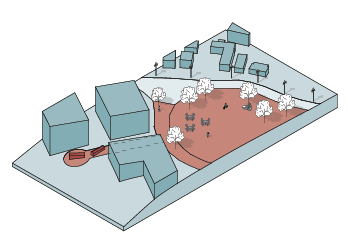
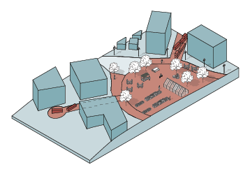
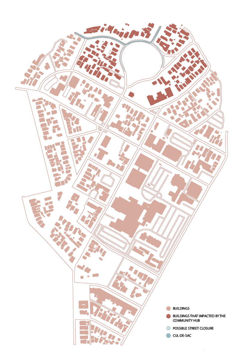
SITE A — BOYLE HEIGHTS
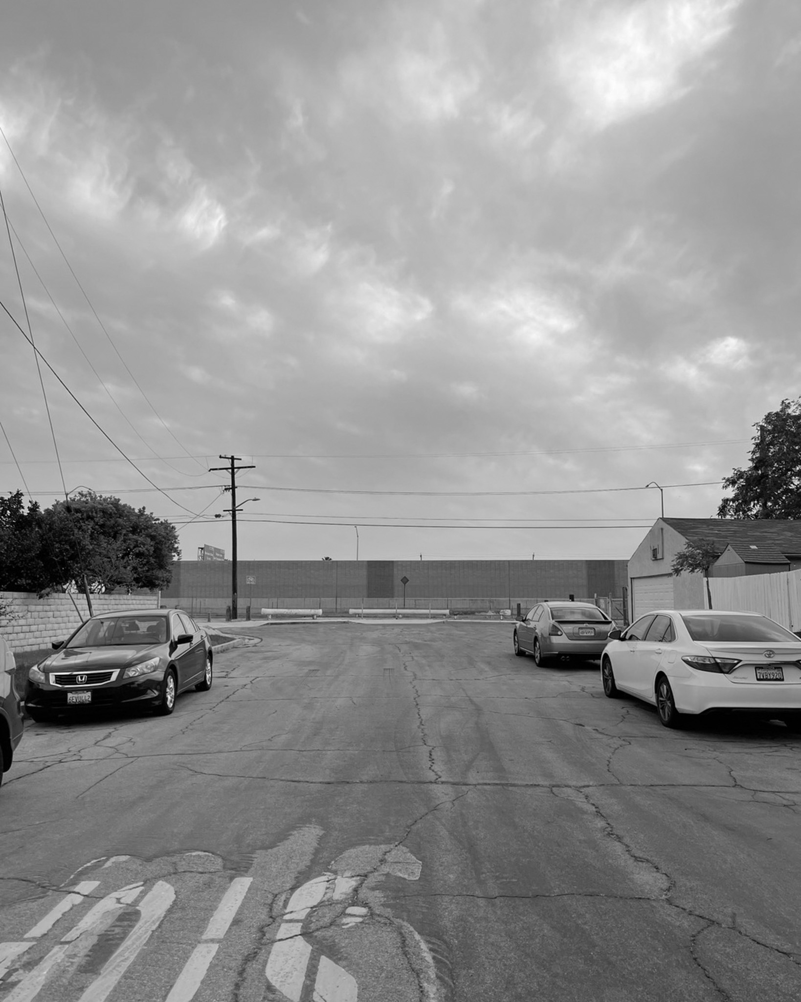
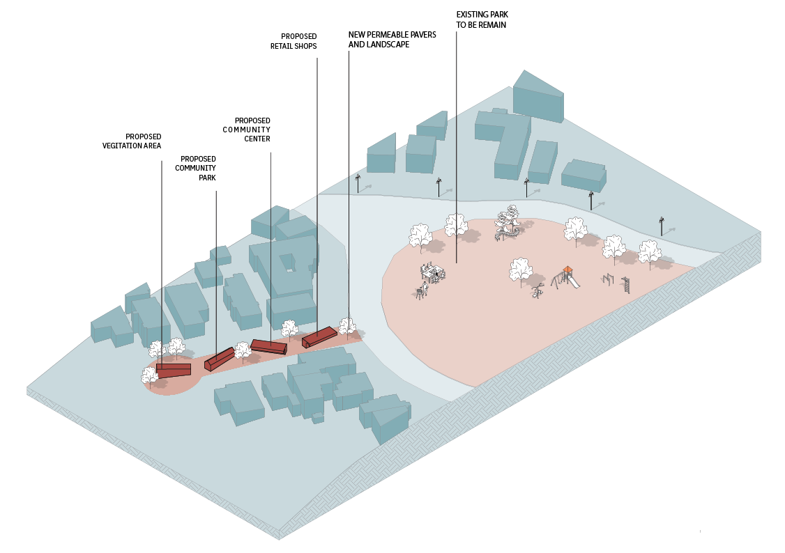
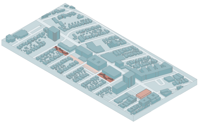
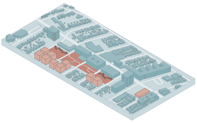
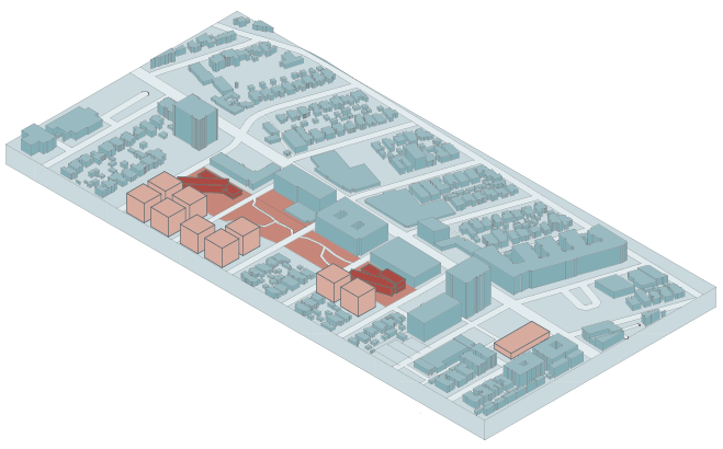
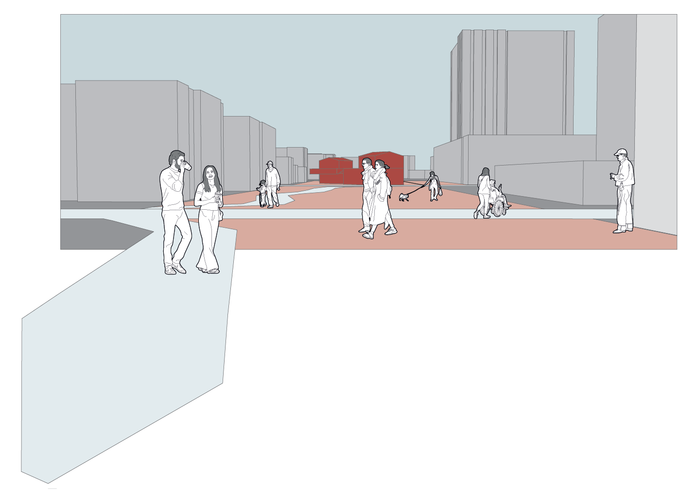
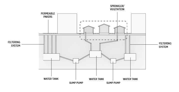
PROPOSED DEPAVEMENT OF UNDERUTILIZED CUL-DE-SAC TO OFFER COMMUNITY SPACE SUCH AS PARKS, VEGETATION AREAS, RETAIL SHOPS AND COMMUNITY CENTER.
THE COMMUNITY HUB WILL VIBRANT, ADAPTABLE PARKS, OFFERING ACCESSIBLE GREEN SPACES, AND FOSTERING COMMUNITY INTERACTION.
10 YEARS: The new community area is formed. The community hub connects with the nearby park as one community hub.
25 YEARS: The hub becomes a deeply ingrained part of the social fabric of the dead-end neighborhoods it serves. Multi-family apartment projects are developed, and more streets to be depraved and closed.
50 YEARS: More multi-family apartment projects are developed. The community hub now connects all intersections near the existing park.
RECYCLING CENTER 1
MAKE CONCRETE AGGREGATE OUT OF DISPOSED OR DEMOLISHED CONCRETE.
EXPORT IT TO THE LOCAL STREET REPAVEMENT
RECYCLING CENTER 2
MAKE PERMEABLE PAVERS FOR ALL DEPRAVED DEAD ENDS.

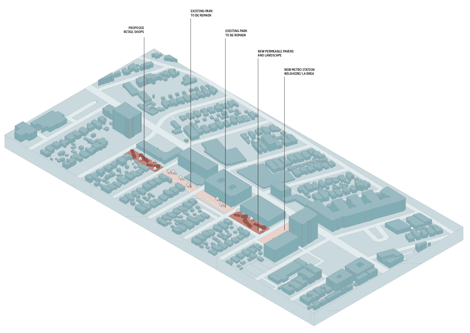
SITE B — MIRACLE MILE WILSHIRE BLVD.
PROPOSED DEPAVEMENT OF UNDERUTILIZED ALLEY TO OFFER COMMUNITY SPACE SUCH AS PARKS, VEGETATION AREAS, RETAIL SHOPS AND COMMUNITY CENTER.
THE COMMUNITY HUB WILL VIBRANT, ADAPTABLE PARKS, OFFERING ACCESSIBLE GREEN SPACES, AND FOSTERING COMMUNITY INTERACTION.
AS THE COMMUNITY HUB LOCATED IN BETWEEN COMMERCIAL AND RESIDENTIAL, IT WILL CREATE MORE INTERCONNECTED FEELING BETWEEN TWO DIFFERENT USES.
10 YEARS: The new community area is formed. The community hub connects with the nearby park as one community hub.
25 YEARS: The hub is a central noce, drawing people from both residential areas seeking local amenities and the commercial areas for lunch breaks or after work activities. The metro station is making the hub a convenient meeting point and destination. As a growth of the pavement of the street, a new recycling center will be located near the site.
Sources
- Clifford, Brandon. The Cannibal’s Cookbook, 2017.
- “Off the Grid…and Back Again?”, Geoff Boeing, https://geoffboeing.com/2020/11/off-grid-backagain/
- “Early Los Angeles City Views,” Water and Power Associates, https://waterandpower.org/museum/Early_City_Views%20(1900%20-%201925)_8_of_8.html
- “Facility List,” Public Works, https://pw.lacounty.gov/epd/CD/cd_attachm ents/Recycling_Facilities.pdf
- “Custodian Citys Street System,” Los Angeles Streets LA, https://streetsla.lacity.org/bureau-street-services-custodian-citys-street-system#:~:t ext=It%20performs%20nearly%20all%20resurfacing,subways%2C%20tunnels%20and%20public%20w alkways.

